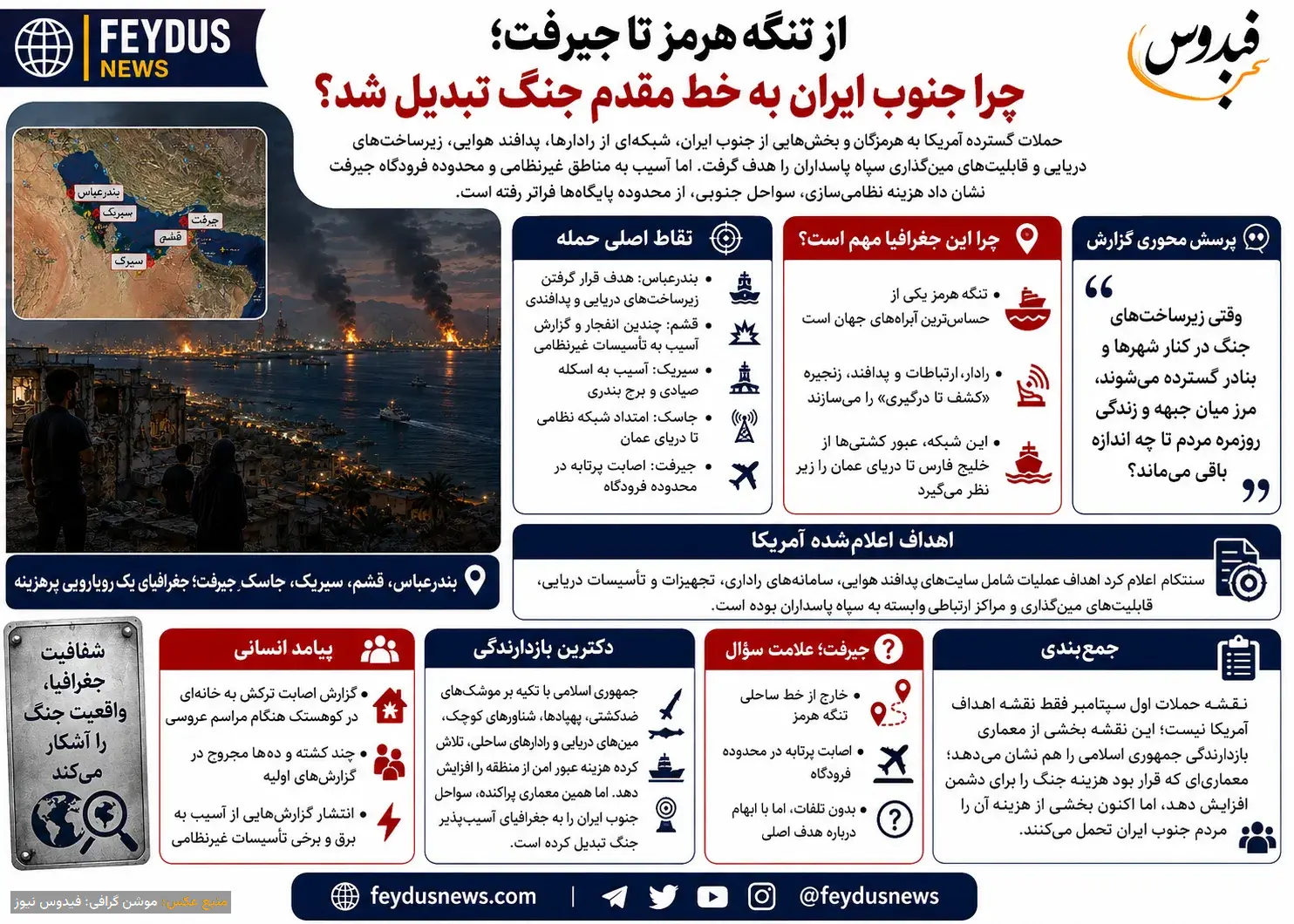
The extensive US attacks on Hormozgan and parts of southern Iran, targeted a network of radars, air defenses, naval infrastructure, and mine-laying capabilities of the Islamic Revolutionary Guard Corps, but the hits on civilian areas and Jiroft airport show that the cost of turning the southern coasts of Iran into part of the Islamic Republic's military architecture has now gone beyond the bases..
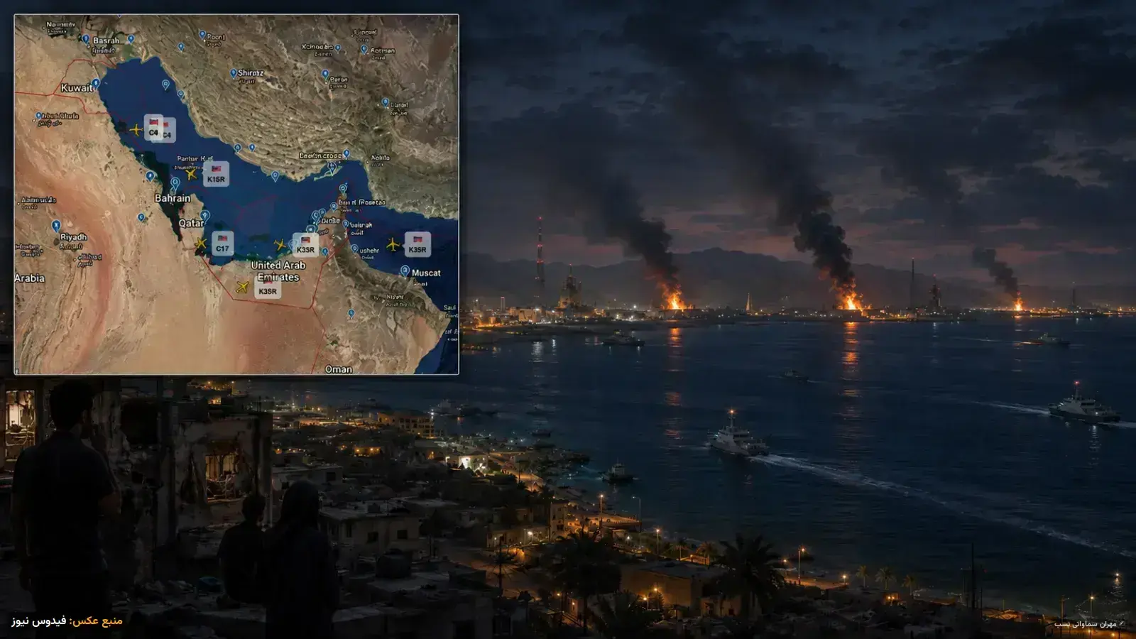
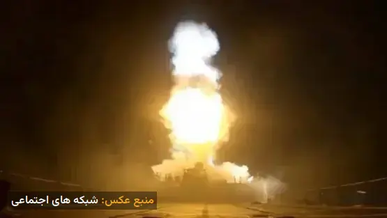
The sound of explosions on Tuesday night extended from the islands of the Strait of Hormuz to the shores of the Sea of Oman. Bandar Abbas, Qeshm, Sirik, and Jask were among the points repeatedly mentioned in initial reports. These points, which may appear as scattered cities and ports on the map of southern Iran, are, from a military perspective, links in a strategic chain around one of the world's most sensitive waterways..
The United States Central Command, CENTCOM, announced after the end of the first wave of attacks in early September that American forces had targeted sites belonging to the Islamic Revolutionary Guard Corps, including "air defense sites, radar systems, naval equipment and facilities, mine-laying capabilities, and communication centers." CENTCOM cited the operation as a response to recent efforts by the Guard to attack commercial shipping in the Strait of Hormuz and American forces stationed in the region..
Donald Trump also said the operation was in response to Iran's attempt to lay mines in the strait and launch missiles at a base housing American forces in Jordan. This American narrative is, of course, part of a dispute in which Tehran offers a completely different account of the legitimacy of Washington's military actions..
However, the geography of the attacks, independent of the political narrative of both sides, reveals an important point: a large part of the Islamic Republic's military infrastructure for exerting power in the Persian Gulf is located near the population and economic centers of southern Iran..
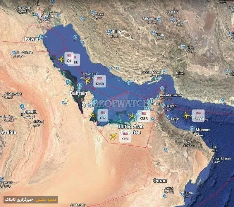
Hormozgan; A Province Beside a Global Chokepoint
The importance of Hormozgan must first be seen on the map. Bandar Abbas is located north of the Strait of Hormuz, Qeshm stretches along this waterway, and Sirik and Jask continue the path towards the Sea of Oman. This geography allows Iran to monitor the movement of vessels from the Persian Gulf to the Sea of Oman from multiple directions..
For this reason, a coastal radar is not merely a detection device. In a modern military network, radars generate data, communication networks transmit this data, and command and weapon systems use it to create a "discovery-to-engagement chain.".
Simply put, having a missile alone is not enough to effectively target a moving ship. First, the target's position must be found and tracked, its information transmitted, and then the weapon system must receive the necessary data for engagement..
This issue explains why in CENTCOM's official list, radars and communication centers are placed alongside naval equipment and mine-laying capabilities. American government officials have described this limited operation as aimed at weakening Iran's radar and missile capabilities related to the threat to shipping in the region..
Bandar Abbas and Qeshm; The Eyes of the Strait of Hormuz
Bandar Abbas is the most important point in this geography. The Associated Press reported that this city hosts naval and air force facilities, and witnesses have reported heavy explosions and smoke rising from the eastern part of the city. A little further, Qeshm has an even more unique position. The island is located along the strait, and its southern coast faces the maritime route..
Iranian media reported hearing several explosions in Qeshm. Iranian state television also said a fish powder factory on the island was hit. Unofficial reports about the airport area were also published. This ambiguity is important. Hearing explosions in a militarized area does not necessarily mean that every damaged building was the main target of the operation..
Sirik and Jask; Extending the Network to the Sea of Oman
Moving east, Sirik and then Jask are located. The strategic value of these areas stems from extending Iran's surveillance and naval network from the Strait of Hormuz to the coast of the Sea of Oman. Thus, the geography of military operations is not limited to the narrow mouth of the strait..
The Islamic Republic News Agency reported hearing explosions in Bandar Abbas, Jask, Sirik, and Qeshm. Iranian state television also announced that a fishing pier and a tower belonging to the Ports and Maritime Organization in Sirik were damaged, but the most serious reported human consequence occurred in this county..
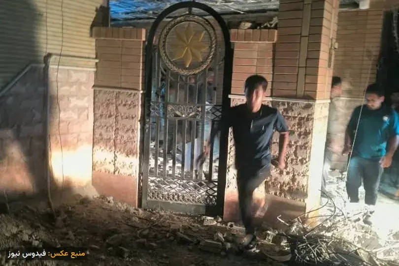
Iranian officials and the Red Crescent announced that shrapnel from the attack hit a house in Kouhestak hosting a wedding ceremony, resulting in several deaths and dozens of injuries. Initial reports on the exact number of casualties varied..
This incident raises a question beyond military calculations: when war-related infrastructure is spread along cities, ports, power grids, and residential areas, how much of a geographical boundary remains between the "frontline" and the daily lives of people?
Jiroft; A Question Mark Hundreds of Kilometers from the Strait
Among the reported points, Jiroft is an exception. Unlike Bandar Abbas, Qeshm, Sirik, and Jask, this city is not located along the coastal line of the Strait of Hormuz. Iranian state television announced that a projectile hit an area outside the runway of Jiroft airport in Kerman province..
According to provincial officials, this attack had no casualties, and the runway and airport buildings were not damaged. At the time of this report's publication, CENTCOM had not provided a specific public explanation about the intended target in Jiroft, so any claims about the presence of a specific military target at or around the airport remain speculative without independent evidence. These unknowns are part of the war's picture..
The Deterrence Doctrine that Militarized Southern Iran
The Islamic Republic has for years tried to compensate for its limitations against the conventional power of the US military with a different set of tools: anti-ship missiles, drones, small vessels, naval mines, coastal radars, and dispersed command networks. The logic of such a structure is clear: to create deterrence, Iran does not need to defeat the US Navy in a classic battle. It is enough to increase the cost of safe passage through the region and show that in the event of war, trade and energy can also be affected..
However, the same dispersed architecture creates a vulnerability. The more military systems are distributed along hundreds of kilometers of coastline, the more potential points of conflict increase. The attacks in early September showed that the opposing side might also target the network components, from radar and communications to defense and naval equipment, simultaneously instead of focusing on a large base..
The official page of Operation "Epic Fury" CENTCOM has also described the overall goal of the US operation as disabling parts of the Islamic Republic's security structure, prioritizing what Washington calls an "immediate threat.".
The Cost That Goes Beyond Military Bases
For decades, the Islamic Republic has presented Iran's geographical position in the Strait of Hormuz as a deterrent lever, but this week's events show the other side of the same equation. Geography that can create power for Tehran can expose those same areas to attack in times of war..
Now in Hormozgan, the issue is not just damage to a radar or a naval facility. Reports of damage to the power grid, civilian facilities, and a house full of wedding guests have been published..
The legal responsibility for any attack and any civilian casualties must be independently examined based on the target information available to the attacker, the principle of distinction, and proportionality; merely having military facilities in a province does not absolve the attacker of the responsibility to protect civilians..
However, at the strategic level, a harsh reality has emerged: the policy that turned the Strait of Hormuz into a military lever for the Islamic Republic has now linked the cities and villages of the same coast to the geography of an international confrontation..
From Bandar Abbas and Qeshm to Sirik and Jask, the map of the early September attacks can be read not only as a map of US targets but also as a map of part of the Islamic Republic's deterrence architecture. An architecture that was supposed to increase the cost of war for the enemy, but now part of that cost is borne by the people of southern Iran.